
District
Arganzuela
According to the City Council, Arganzuela is the southward extension of the Historic Centre. Until the 18th century it held only service installations, and under Charles III the…
Areas
Guides to districts, neighbourhoods and municipalities, written to help you decide where to live, buy or rent.
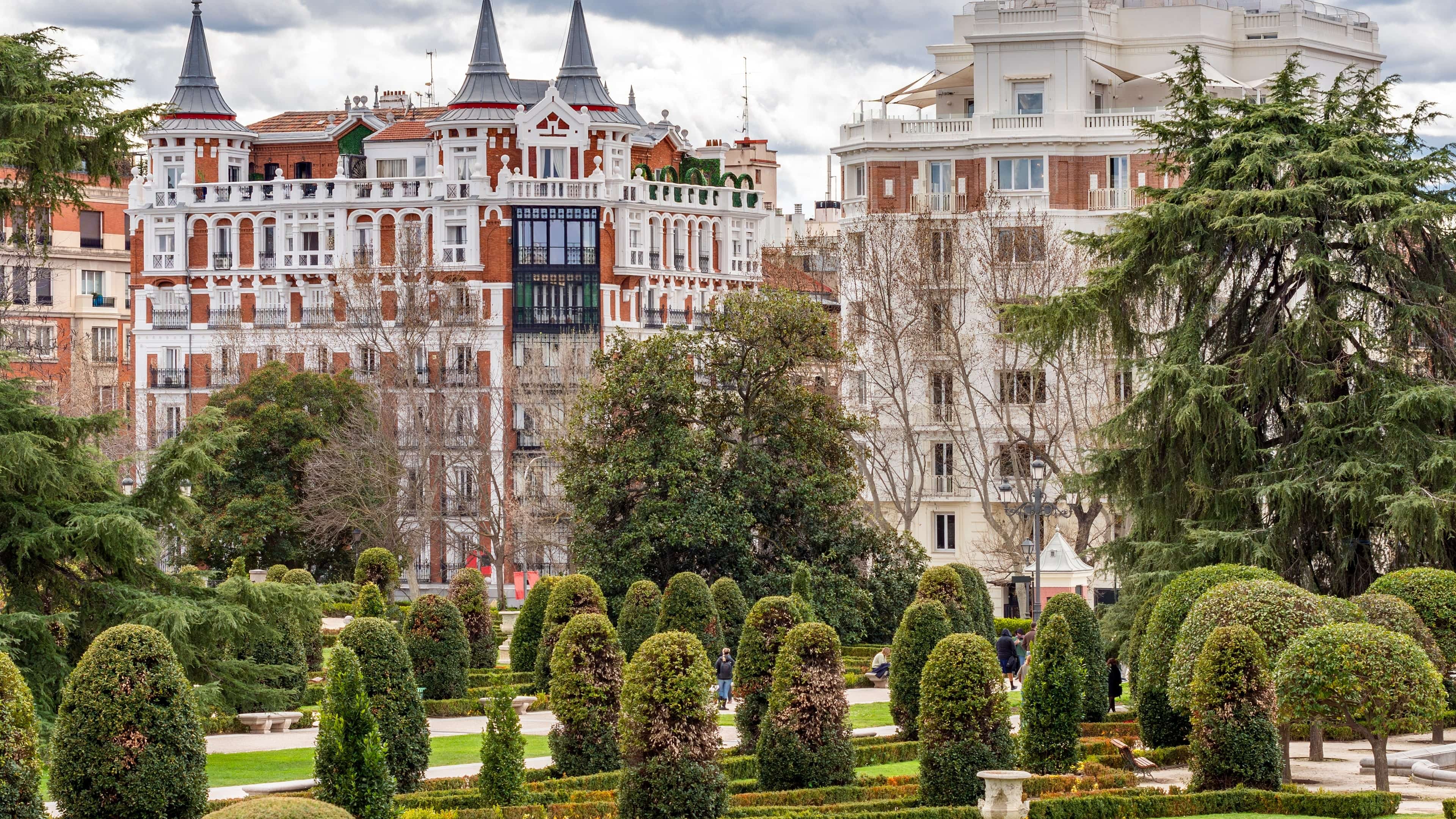
Areas
The scale of the city.
District
According to the City Council, Arganzuela is the southward extension of the Historic Centre. Until the 18th century it held only service installations, and under Charles III the…
District
According to the City Council, the municipality of Barajas was annexed to Madrid by the Decree of 18 November 1949. Until the 1987 restructuring its territory was part of the…
District
According to the City Council, Carabanchel grew from two small towns, Carabanchel de Abajo and Carabanchel de Arriba, later renamed Bajo and Alto, whose fields supplied the…
District
The Centro district is made up of six neighbourhoods: Palacio, Embajadores, Cortes, Justicia, Universidad and Sol. It is where history weighs most in the city, and a single square…
District
According to the City Council, Chamartín was the central district of Madrid with the latest development: until after the Civil War only the Prosperidad neighbourhood and some…
District
According to the City Council, Chamberí takes its name from the French "Chambery" regiment, which camped in the area during the War of Independence. The district emerged from 1860…
District
According to the City Council, in 1892 Arturo Soria y Mata published the "Linear City Project around Madrid": a city that would ring the capital outside its municipal boundary and…
District
According to the City Council, Fuencarral-El Pardo is the largest district, at 23,783.84 hectares, and 90% of its land is woodland such as El Pardo, El Goloso, Soto de Viñuelas…
District
According to the City Council, Hortaleza occupies the northern tip of the municipality of Madrid and covers land from the former municipalities of Canillas and Hortaleza, annexed…
District
According to the City Council, the area was a crossroads near the bridges of Toledo and Segovia, where the Extremadura road met, known until the 17th century as the road to…
District
According to the City Council, Moncloa-Aravaca spreads across the broad north-western arc of the city, around the A Coruña road, and has four distinct zones: the old core of…
District
According to the City Council, the Moratalaz area was once a single property, the Moratalaz pasture. A single development company built it in a planned, unified way, and the…
District
According to the City Council, the district was created in the restructuring of 28 March 1987, when the former Vallecas district was split in two: Puente and Villa. The…
District
According to the City Council, Retiro's history is shaped by the park that gives it its name and by the railway installations in the south and east of the district. The park and…
District
Salamanca grew out of the 1860 Castro Plan, Madrid's first Ensanche (urban extension). According to the City Council it is one of the most representative areas of the bourgeois…
District
According to the City Council, San Blas-Canillejas includes land that belonged to the municipalities of Canillejas, Barajas, Vicálvaro and Canillas. Until after the Civil War the…
District
According to the City Council, the origin of the area lies in 1860, when the Spanish troops who fought in the War of Africa camped on the Dehesa de Amaniel, land that no longer…
District
According to the City Council, Usera was created in the latest restructuring, dated 28 March 1987. It is bounded by the Puente de Praga, Paseo de Santa María de la Cabeza, Plaza…
District
According to the City Council, Vicálvaro covers the old rural core and the settlements that formed around it, at first governed by deputy mayors dependent on the municipality.…
District
According to the City Council, proximity to Madrid favoured cereal growing, which replaced vineyards and olive groves. In the second half of the 19th century relations with Madrid…
District
According to the City Council, Villaverde was a rural settlement close to Madrid, with cereal land, pastures, gardens and orchards, and it had bread ovens and tile works. Its…
Areas
Beyond the capital.
Municipality
Alcalá de Henares is a municipality in the Community of Madrid. According to the Community of Madrid's statistical tables, it covers 88.2 km² and lies 32.8 km by road from the…
Municipality
Alcobendas is a municipality in the Community of Madrid. According to the Community of Madrid's statistical tables, it covers 45.25 km² and lies 18.2 km by road from the capital.…
Municipality
According to the Town Council, the first medieval document to mention Alcorcón dates from 1208 and speaks of the "Cañada de Alcorcón", a livestock route and boundary of the…
Municipality
Arganda del Rey is a municipality in the Community of Madrid. According to the Community of Madrid's statistical tables, it covers 80.32 km² and lies 28.6 km by road from the…
Municipality
According to the Town Council, in the second half of the 14th century Día Gómez de Toledo asked to settle the lands with 80 Segovian residents, and in 1352 he was the…
Municipality
Boadilla del Monte is a municipality in the Community of Madrid. According to the Community of Madrid's statistical tables, it covers 47.49 km² and lies 24.7 km by road from the…
Municipality
According to the Town Council, building the monastery of El Escorial under Philip II absorbed a lot of labour from nearby villages, and it is "more than likely" that Villalba…
Municipality
According to the Town Council, around 1236 Segovia founded the pueblas of Manzanares and Colmenar to secure its rights over the area, in the pasture conflict with Madrid. Alfonso…
Municipality
Coslada is a municipality in the Community of Madrid. According to the Community of Madrid's statistical tables, it covers 12.03 km² and lies 12.9 km by road from the capital. The…
Municipality
According to the Town Council, on 15 April 1561 Philip II wrote to the Superior General of the Hieronymite order to tell him he had "decided to build and endow a monastery". The…
Municipality
According to the Town Council, Fuenlabrada arose from the repopulations by the Castilian kings in the 12th century, from the hamlets of Loranca and Fregacedos, resettled with…
Municipality
Getafe was known for aviation long before its property market. According to the Town Council, the air base was permanently established in 1911, the Civil Aviation School was…
Municipality
Humanes de Madrid is a municipality in the Community of Madrid. According to the Community of Madrid's statistical tables, it covers 19.68 km² and lies 31.2 km by road from the…
Municipality
Las Rozas de Madrid is a municipality in the Community of Madrid. According to the Community of Madrid's statistical tables, it covers 58.34 km² and lies 20 km by road from the…
Municipality
According to the Town Council, before Leganés there were settlements in the hamlets of Butarque and San Juan de Overa, La Torrecilla and the hillocks of the La Mora estate and…
Municipality
According to the Museo de Historia de Madrid, in 1561 Philip II made the Villa the permanent seat of the Court, which increased the population and prompted Philip II's city wall…
Municipality
According to the Town Council, Segovian shepherds are believed to have settled around the 13th century and built a few huts, although the discovery of a Roman-Visigothic…
Municipality
Móstoles' City Museum places the municipality's first secure appearance in a document of October 1144, a grant by Alfonso VII to Segovia Cathedral, although the area had been…
Municipality
According to the Town Council, Navalcarnero was founded on 10 October 1499 with the appointment of its first council, made up of six residents who until then belonged to Perales;…
Municipality
Paracuellos de Jarama is a municipality in the Community of Madrid. According to the Community of Madrid's statistical tables, it covers 43.81 km² and lies 24.7 km by road from…
Municipality
Parla is a municipality in the Community of Madrid. According to the Community of Madrid's statistical tables, it covers 24.99 km² and lies 23.7 km by road from the capital. The…
Municipality
According to the Town Council, at the Tinto Juan de la Cruz site remains of a 5th-century barbarian camp built on a Roman villa were found, and two Visigothic necropolises are…
Municipality
According to the Town Council, the name Pozuelo first appears in 1208, when Alfonso VIII set the boundaries of Segovia with Toledo, Madrid and Alamín. It lay in the sexmo of…
Municipality
According to the Town Council, the old Vaciamadrid was devastated by the Civil War. On 23 July 1959 the new village of Rivas Vaciamadrid was officially inaugurated, replacing the…
Municipality
According to the Town Council, a royal decree of 29 June 1746 ordered the purchase of Torrejón de la Ribera to set up a factory for superfine cloth, and Ferdinand VI took…
Municipality
According to the Town Council, the settlement would have been established in the early 12th century under the protection of a fortification built by the people of Alcalá, although…
Municipality
Torrelodones is a municipality in the Community of Madrid. According to the Community of Madrid's statistical tables, it covers 21.7 km² and lies 30.3 km by road from the capital.…
Municipality
Tres Cantos is a municipality in the Community of Madrid. According to the Community of Madrid's statistical tables, it covers 37.99 km² and lies 24.6 km by road from the capital.…
Municipality
Valdemoro is a municipality in the Community of Madrid. According to the Community of Madrid's statistical tables, it covers 64.19 km² and lies 28.8 km by road from the capital.…
Municipality
Villanueva de la Cañada is a municipality in the Community of Madrid. According to the Community of Madrid's statistical tables, it covers 34.84 km² and lies 43.2 km by road from…
Municipality
Villanueva del Pardillo is a municipality in the Community of Madrid. According to the Community of Madrid's statistical tables, it covers 25.4 km² and lies 28.8 km by road from…
Municipality
Villaviciosa de Odón is a municipality in the Community of Madrid. According to the Community of Madrid's statistical tables, it covers 68.23 km² and lies 26.2 km by road from the…